The Arizona Trail – Anderson Mesa
It seems that any worthwhile hike in Arizona is going to start with something like what we find in the above image…waking a couple of hours before dawn and driving for those same hours to make it to the trail-head before the potential swarm of other humans and the known and persistent presence of the warming/heating/baking sun….
It was 4:37 am in the first image and then 7:12 am with this next one…145 miles later….
In my estimation, nothing compares with the sunrise on a forest trail…or a forest trail at sunrise…a most wonderful place to be on a September Sunday morning.
Many people know of the Pacific Crest Trail and the Appalachian Trail…but maybe not so many know about the local version of those adventures, The Arizona Trail. This is a cross-state trek that literally goes from the US/Mexico border in the south, all the way up to the Arizona/Utah border in the north…800 miles of trail broken into 43 segments that can be accessed from various locations and hiked individually…as simple out and back day hikes, or as overnight backpacking treks…or however else one might desire to experience them. You can click on each of the above trail names to be taken to their internet home pages.
For those of you who have been following/visiting the blog for at least the last four years, you might remember various posts about Marshall Lake, Fisher Point, hiking in the Coconino National Forest, etc. The majority of those posts came from my hikes along the segment of the Arizona Trail that goes north from Marshall Lake to beyond Fisher Point…a stretch of the trail that is known as Passage 31: Walnut Canyon.
While it would be something of a dream to be able to thru-hike the entirety of the trail, the constraints of my life as it currently exists only allow for occasional forays. That said, I have hiked the southern part of Passage 31 four times over the last four years, so it seemed like it was time to try another segment…and for simplicity’s sake, I chose the one that heads south from the same trail-head at Marshall Lake…Passage 30: Anderson Mesa. For those interested, the numbering of the passages goes from south to north…Mexico to Utah.
If I’m going to be especially honest about this particular adventure, there was nothing thrilling about it…the only landscape change was going from my parking location down closer to Marshall Lake, up through a couple hundred yards of oak and pine forest, and then onto the plain of the mesa.
There was a lot of open sky…and prairie grass that was much greener than one can see in these photos…. Again with the honesty thing, I should include that it was still interesting…largely because it was different and unknown.
The middle “peak” in the above image of the San Francisco Peaks is actually the highest point in Arizona…Humphrey’s Peak…at 12,633 feet in elevation. I spent the better part of a Sunday climbing up and down that mountain three Septembers past…a wonderful and crowded adventure that you might remember from this post.
As I hiked and as the hours pressed onward, I kept waiting for something “more,” which didn’t and couldn’t really happen, given that I was hiking on the top of an essentially flat mesa…I had to look closely…to consciously view things with “new” eyes….open ones…watching eyes…even then it became a bit……..monotonous.
If I had had unlimited time and endurance, I could have gone the entire length of this particular segment, which was something like 17 miles…and I would have encountered scenery that would have been less…….monotonous.
But…the mountains were there, behind me, the temperature was in the 50s at the start of the hike and only in the mid-70s toward the end…so it was still a good…pleasant adventure.
Less than a mile from the trail-head, the trail passed the Lowell Observatory…and then it passed Prime Lake and Vail Lake. From what I could see, only Prime Lake contained water. Both bodies weren’t “lakes” as we often imagine them, but were more of marshes whose water levels would raise with the seasons. They were also both fenced and posted with signs identifying them as preserves or refuges for wildlife and migrating birds.
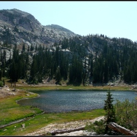
The open space in the above image is Lower Lake Mary…not holding any water when I was there…but which contained some during my visit last year which allowed me to capture this image…something I was hoping to duplicate on the morning of this hike.
Hiking across the open plains of the mesa did bring a couple of “firsts” with this adventure…the first time I saw antelope and a coyote while out on a hike. I have seen them plenty of other times, mostly while driving, but this was the first occasion of actually encountering them out in the “wild.”
The first image of the San Francisco Peaks above was from 8:26 am…and the one below was from 11:23 am…three busy hours in the jet-stream hauling clouds from their wherever places to the high desert and mountains of Northern Arizona.
Thank you for visiting. I hope you enjoyed this brief glimpse into The Arizona Trail…..
A view from Marshall Lake, Arizona
A last reward after a long hike in northern Arizona…a view of the San Francisco Peaks from the shore of Marshall Lake (marsh) in the Coconino National Forest, just south and east of Flagstaff. Wouldn’t it be wonderful to live in that cabin in the distance….?
Fisher Point perspective
Just over two years ago, I took my first “Arizona hike.” I had journeyed up to the Coconino National Forest just south of Flagstaff and ventured along part of the Arizona Trail to the convenient turn-around location of “Fisher Point.” In reflecting upon this particular landscape feature, I have referred to it as a stone tee-pee, as that’s how it appears….
I suppose the mass might appear to be large enough on its own, but I thought the miniature human bodies would help provide a bit more perspective. The “doorway” of the bottom of the rock is a bit of a cave that doesn’t go too far into the rock…maybe 20-30 feet. Fisher Point, by the way (unless I’m mistaken), is atop this particular stone tee-pee. There is a trail that takes curious hikers up through the draw to the left of this rock, winds up and along the hillside, and finally deposits them at a safe distance from the edge that still allows a greater view of the canyons and meadows that exist around the Point.
the fecund mother?
another rendering of archetypal mother…maybe…that’s what I thought, anyway, when I came upon this pine cone nestled into the curve of an old branch on the forest floor
Red-Dome Blanket Flower…?
Hmm…I’m not sure, but I’m inclined to say, “Not,” as the petals look different than what they should. At any rate, these appear to be part of the Asteraceae family…and I found them in the meadows of Walnut Canyon and in the dry bed of Marshall Lake…both in northern Arizona, just south and east of Flagstaff.
After the Fisher Fire….
My hike this past Sunday was in the Coconino National Forest just south and east of Flagstaff, Arizona.
The trail-head was 128 miles and about 90 minutes from my doorstep in north Phoenix…which is quite a change from my former hiking environment in the Salt Lake Valley…the Wasatch Mountains, in general, and, as pictured below, Little Cottonwood Canyon, in specific (among other places). You might remember me mentioning a couple of times in the past that I could be to the nearest trail-head in the time that it took me to drink a cup of coffee.
Ah, well…those are memories now…and where I live in this present stage of my life situates me, like I said, 128 miles away from this particular trail…yes, there are closer trails…and yes, most/many/lots of them are found in and among the desert “mountains”…with nary a bit of shade…and temperatures that soar up into the “hundred-and-some-teen” degree range (100 – 119 or higher)…so I drive north to the mountains.
At any rate, I hiked the particular trail that leads from Marshall Lake to Lewis Point…a 13.8 mile round-trip excursion through a Ponderosa Pine forest, down into what I understand to be part of Walnut Canyon, to the limestone prominence and canyon over-look of Lewis Point, and then back to the starting point.
This was a new forest and a new trail for me…a new experience, essentially. Another part of the newness was hiking through a forest where a wildfire had raged only three months ago. I’ve driven past locations along the freeways or highways that had been burned over the years and had hiked among the charred skeletons of scrub-oak trees that had been burned in many seasons passed, but I’ve never had the incredibly intimate and awe-inspiring experience of walking through a forest that had been so recently in flames. To add to the eeriness of the situation, there was visible and “smell-able” smoke in the canyon from controlled burning that the forest service was conducting many miles south.
Please remember that you can click on any image in the gallery to be taken to a slide-show where you can view the photos in a larger format.
If you’d like more information about the Fisher Fire, you can check-out this link from April of this year…it has another link to the Coconino National Forest’s Flicker account which shares images of their more recent (and historical) fire-fighting efforts, as well as many others that show the beauty of this northern Arizona national forest.
the forest and the trees….
This is an image from my first true hike since moving back to Arizona…it was a different kind of forest with its own smells and sounds, but it was rich in its reward of peace and solitude. I only saw one other person for the first almost five miles…a stealthy mountain-biker who crept up on me as I was kneeling just off the trail making photos of some pine cones and flowers…startled the hell out of me…but otherwise, it was quiet in the way that woods are supposed to be with only the breeze blowing through the tree-tops, the occasional bird letting me know that she/he had seen me, and the sounds of my footsteps on the trail.


