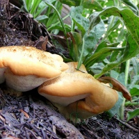
Myrtle Spurge…and moments of a day….
It is almost as if I had been a child again, out exploring unknown and unsanctioned regions, far from home and the general safety that accompanies being in a place so named, a place where there were expectations and things that could be anticipated, good or not. I was out in an area that had at least an essence of wildness and things not seen before, things not encountered previously other than in imagination or wonder, in an area that was not touched by expectations or any anticipation other than the ones that compelled me to be there to begin with. Memories of my childhood situated me along slow-moving streams where the water was clear enough to see crawdads sitting motionless and tucked up under various shades of brown and gray rocks on the bottom, where my arms would be unknowingly scraped and sliced with moving among the tall reeds and brush that I had to penetrate to make it down to the stream, standing along the inside of a bay where I imagined that I could see dolphins’ and sharks’ fins cutting through the smooth or choppy water while military jets soared overhead, and where my presence in that other world was a welcome escape from the one where things were known and anticipated. I find images in my mind, too, of old country roads with black and red raspberry bushes growing in hedge-form on the other sides of ditches that separated grassy fields of Dandelions and Queen Anne’s Lace growing in wild profusion…a road leading to a ruined castle, or another one or two that carried me to a sportsplatz and a logger’s camp in the deep pine forest…roads and pathways that led to places crammed full of a child’s joy in being out and away.

I had thought of those things then and now as I recount the day that I noticed the bright groundcover on a berm that we had to cross to make our way down to the lake…two hundred yards or more between where we parked and where we were intent on going. The tightness of the leaves and the tiny cups of bright green, the inhospitable looking soil where they seemed to thrive, and the image of the lake and the snow-capped mountains beyond…all things noted and tucked away…stored now with what must be emotions or sensations of peace, contentment, and real happiness…a word that I don’t often use because the gap between perception and experience has been so wide. But that’s where those memories are now, the lake and the mountains and the myrtle spurge and the company of my son…they are enveloped in a spot of truly happy serenity back there in the memory files somewhere.

Mt Timpanogos in early Spring
This is yet another photograph from last April when I spent the better part of two days exploring the countryside south and west of my home in the Salt Lake Valley of northern Utah, USA. I made this photo while standing on the side of a road in Cedar Valley, facing the eastern horizon and the mountains of the Wasatch Range.

Farmland and mountains in Goshen, Utah
In this image from April, 2013, you can see the early spring greenery on the fields and hillsides, while there is still a fine covering of snow on the distant Wasatch Mountains. Goshen is approximately 50 miles south of the Salt Lake Valley, in Utah County, and just a bit south of Utah Lake…the fresh-water lake that drains north via the Jordan River into The Great Salt Lake.


Fields of Cedar Valley
From looking at a map of the area, I want to say that the draw (the “V” area just above the fence-posts) is either Pole Canyon or Four Mile Canyon…but I’m not certain….. This was taken facing north from Cedar Fort Road…out in Utah County…a bit north of Eagle Mountain.


A tractor for Timpanogos
There are acres and acres of fields just north of the Cedar Fort road that leads into the Cedar Valley of Utah County and beyond. A week or so ago, I shared a photo, “farm and mountain panorama,” that had a tractor in a field beneath the snow-covered Oquirrh Mountains, the range that provides the western border for the Salt Lake Valley…and contributes to the north-western border of Cedar Valley. I returned to the area the following weekend and made some photos while facing the other direction…toward the Wasatch Mountains in general, and toward this mass of rock and earth, specifically, that is known as Mount Timpanogos…a very prominent feature of the eastern skyline for much of Utah County…which is located directly south of the Salt Lake Valley…and Salt Lake County proper.

Tintic Standard Reduction Mill
A week or so ago, my second son and I headed out into the beyond…took a tour around Utah Lake…essentially followed in the tire-tracks of my third son who had made the trip on his bike last summer. At the southern end of the lake, the road heads back east. About two and a half miles past the town of Goshen, you can see what appears to be the remains of something on the side of a mountain. Even from a distance, you can also see that it has been frequented by taggers and graffiti artists. My cycling son had mentioned the ruins after his ride and suggested that we needed to check it out sometime.

After leaving this site and finding a stronger signal for his phone, my second son determined that these were/are the ruins of the Tintic Standard Reduction Mill…an ore processing facility that was built between 1919-1921…and only used for four years…so it has been standing vacant and abandoned since 1925. For a very brief history of the mill, you can click on the highlighted name to be taken to the Wiki article that provides a bit of information.

This link to the Historic American Engineering Record provides a more extensive history…and shows us what the ruins looked like back in 1971, after it had been abandoned for 46 years, and before a select demographic of our country decided that they needed to decorate the place with their spray-painted opinions and expressions of art. The following images represent what the place looks like today…42 years after the essentially “clean” images from 1971…and 88 years after it was abandoned.

The entirety of the mill structure spans an elevation equivalent to eight stories of a building and is situated on the side of Warm Springs Mountain, 5,535 ft elev.

The circular structures are leaching vats where the crushed ore would be chemically processed to remove the silver, copper, lead, and gold.


Don’t know enough about it to even guess what the circular things below were/are….

Under the vats…supports…drains(?)…retention walls….

The inside of a leaching vat…

These are the ore bins toward the right of the photo…above the leaching vats.

A view looking over the ore bins…with my son at the far end.

.

My son looking into the silver precipitator…the square-shaped structure with the conical (inverted pyramids) chute underneath…situated to the left of the leaching vats in the third photo above.

If you click on the link for the Historic American Engineering Record, you can see the diagrams that identify the various parts of the mill that I have named in the post…the leaching vats, silver precipitator, ore bins, roaster, etc….
I believe that’s the water tank in the photo below…with Savannah and Shilo painted on it…….and if you look in the very first photo above…and notice the somewhat removed, shadowy structure to the very bottom right, those are the lead precipitate bins…..

Looking over the ore bins…in the opposite direction.

The front of the roaster section….

I believe the space between the large structure on the right side of the image and the broken-through wall (that general area) is where the crusher was located…and the large structure is where the ore was roasted.

Warm Springs pond/lake below the mill….


Looking over the roaster, ore bins, silver precipitator, and leaching vats….

The below image is from the highest, developed area of the mill…where I was standing on the remaining foundation of what I believe you can see in the very top left corner of the last image of the post.

The Tintic Standard Reduction Mill before its decline….

Hmm…so this post was quite a bit longer than my normal fare…but I hope you enjoyed it anyway…..
As always, thank you for being here.


when I see them…
When my family and I moved to Salt Lake City, Utah, a couple of years ago, a new dimension was added to our lives. My third son was introduced to and became near obsessed with road cycling…. It became his thing, his activity, part of his daily life…riding hundreds of miles each week, up and down the hills and into the mountain canyons that surround the Salt Lake Valley.

My son and his little family have since moved back to Arizona…and he has spent the last few months getting used to riding the desert roads and highways that criss-cross the greater Phoenix area, the Valley of the Sun….

While I was never inconsiderate or discourteous to cyclists when I encountered them on the roadways wherever I have lived, I became even more aware of their very pronounced presence in the Salt Lake area…cyclists are absolutely everywhere around here…and my son was one of them.

While he no longer lives here, I can’t help but think of my son when I see cyclists out on the road…can’t help but recall his recounting of rides that he took out into the countryside that surrounds the greater Salt Lake area…greening fields in the springtime with snow-covered mountains in the background…that solitary rider out there racing against himself and the wind and the angle of the roadway…that joy in his beating heart…riding…riding…..

East toward the Wasatch….
Another image for Gunta…situated near Eagle Mountain, Utah…west of Lehi and Provo…looking east toward the Wasatch Mountains….