Another rendering of “The Road Home”

A sketch rendering of the image from the post, “The Road Home.”
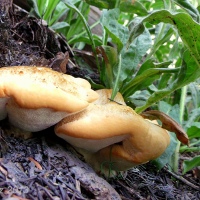
A gift from my son, HB.
Winter Clouds over Mountains
It has been several years since I have had the opportunity to behold the beauty of a snow-blanketed plain with mountains in the background and a serendipitous flock of clouds overhead.

Somewhere north of Scipio and south of Nephi, Utah, a northbound roadside view looking east from the side of I-15, heading home for the holiday.
The Road Home

The image in the rear-view mirror caught my attention while heading north for the holiday…an impromptu stop along the highway captured a new memory affirming photograph of home.
Looking south along I-15, somewhere between here and there in Middle Utah.
American Bison in Context
August 14, 2019 was the 33rd Wednesday of the year….the 54th day of Summer…and the 226th day of the year. It was also Pakistan Independence Day…and World Lizard Day…six police officers were shot in Philadelphia on this day…and the Arizona Diamondbacks lost to the Colorado Rockies by the score of 6-7.

I was up from the desert to visit my Utah kids and to hike on Antelope Island…and to see a summer sunrise from a favored place.

It may seem odd to find American Bison on a large island out in The Great Salt Lake in northern Utah…but they’re there anyway and they create something of an allure to visitors from both home and abroad.

Wikipedia provides that there are between 550 and 700 individual bison on the island during any given year…and that, because of the lack of natural, non-human predators, the herd can increase by about 25% per year.

I saw 5-6 different groupings of the bison during my hours on the island that day…including this medium-sized collection and another one that I will share in a later post.
on the consideration of clouds….
Driving north for a family event and celebration….

A small collection of roadside images made over the span of two hours and five minutes….

Traversing approximately one hundred and fifty miles….

And representing three of the United States….

Nevada…Arizona…and Utah….
Toward Lady Finger Point
One might suggest that we “stole away,” my son and I, when his wife (whom I refer to as my daughter, as she is so precious), took their girls to a Halloween party in the neighborhood. We went on another excursion to a favored place of ours, Antelope Island State Park, just north and west of Salt Lake City, in the southeast portion of The Great Salt Lake. On our four trips out to the island, we have seen some familiar sights, but like on each of the other ventures, we managed to see parts of it that were new to us, as well. On this occasion, we headed-out to Lady Finger Point…and then beyond, to Egg Island, a portion of our day’s wanderings that I will cover in another post.

Maybe I should have used the above image in my recent post, Antelope Island Reflectioning, but it was rather removed from that locale, so it seems to fit better with this one.

With the wide-open spaces and the distant horizon, it’s difficult to ascertain distance and size…

…so it was rather fortuitous when a couple of fellow-wanderers happened into my gaze, in the above photo, when we were checking-out the area from the elevated trail.

This last photo shows the bit of revealed lake bottom that leads out to Egg Island…that perch of elevated ground immediately in front of us out there. I was struck by the lines of residue that the receding water left behind over the past months (?)…captivating and leading our line of sight to the west and beyond to what was formerly unknown to us, except in name only…Egg Island.
If you’re interested in viewing other posts from our wanderings on Antelope Island, you can scroll to the bottom of the page and click on the titled link under the Categories widget.
Millcreek Stream in October….
I had visited the canyon probably multiple dozens of times during the three-plus years that I lived in the Salt Lake valley, but this was the first time I actually hiked/walked on this particular trail. It’s more of a nature walk…or even just a pathway going from one picnic area to another…in the forest, alongside a stream, in the mountains, alone, with an occasional car to be heard coming or going up or down the canyon road…no crowds, no yelling teenagers or smaller people, just the sound of the stream, the chilled air, and the smell of a wet forest floor caught riding the occasional breeze to make me feel that I was where I belonged.

Heading North Again….
Another glimpse of the locale from my trip north in June of this year….

Some of the images may look familiar, as I have already posted similar photos taken from different perspectives.

I will be heading back in a few days…a gift from my children…bringing me to the mountains…since they can’t come to me.

Fall in the Wasatch Mountains is awaiting…

…like granddaughters’ arms…to embrace me.
Lake Blanche in June…reprise….
The parking lot was already mostly full when my son and I arrived at the trailhead, but that was okay, as we/I prefer to park just off the road in the canyon…it’s easier to leave that way…hours later when the hordes of people are milling about with their comings and goings…. Aside from simply driving up into the canyon, one of the first wonderful things about this particular trail is the bridge crossing over the Big Cottonwood Canyon stream. Whatever the month or season of the year, it’s an almost magical, soul-moving experience to stand on the bridge or next to the rushing stream, watching the water make its way down-canyon. This photo shows the crush of the snow-melt…those billions of flakes that have returned to their primal form, filtered through the mountain’s soils and rocks and the vegetation’s roots…and now come at last to the stream-bed where they will be carried away and out into the city below.
Can you hear it…the rushing liquid surge that sounds like a a storm of wind in the high trees…can you feel the chilled air rushing with it down the canyon and into your face…enveloping your body…marveling your mind…soothing your soul…?

It had been more than three years since I had hiked this path, and being honest with myself, I had forgotten how steep the trail was at times…had forgotten how the faces looked of the people struggling up it as I had come down it on my many returns over the years…. It was the roughest hike I had made in quite some time…and one that didn’t use to be such a challenge.

Wonderful life in its simpler forms…the magic of a coming transformation found along the trail.

We’re not there yet, but this is one of the first glimpses of Sundial Peak as viewed from down the canyon…with the brilliant greens of the new summer growth, the patches of snow still extant on the east-facing slopes of the surrounding mountains, and the white trail of the stream that I know is running in its fullness as it drains from Lake Lillian.

Still on the approach, we can see Dromedary Peak to the right and the “Play Doh” like red rock in the foreground whose surfaces were smoothed by the passing of ancient glaciers many millions of years ago….

Looking over those smooth red rocks and back down the canyon in the photo below.

Getting even closer now, preparing for the final ascent up to the flat land before the lake…with a couple of hikers for near perspective.

I never made it up to the top of Sundial Peak during my years of living in the Salt Lake valley, but it was always something I wanted to do…something that I thought I would get to do on some weekend jaunt up there when those mountains were in my every-day…when they were a steadfast part of my eastward view.

The clouds were alive and moving with the strong breezes and winds that blew through our morning up at the lakes…constantly causing shadows to move over the water and mountain peaks….

Below is the view further to the west of the above images…where we can see the breached dam a the far end of Lake Blanche…

…and we know that the water continues down to Lake Florence and Lake Lillian…seen below in their descending order…stair-steps of cascading wonder….

We didn’t have sufficient time to explore for hours and hours like we did the first time my son and I made the trip up here in 2011…but the reward at the end of our hike up there was rich enough in itself to have made the entire effort worthwhile.

Lake Blanche and Sundial Peak in memory form.
Thank you for being here….
A Glimpse at Bells Canyon’s Upper Falls
After my daughter and I hiked to the lower falls, as featured in this post, we continued up the trail for about another hour and then arrived at the upper falls. Amid the spray and the treacherous footing on the soaked boulders and ground, it was difficult to manage another angle that would have provided a better or more clear perspective or presentation of this natural water-feature.

We stood in literal awe for several minutes, shifted our positions to gain different perspectives, stayed there again for several more minutes, and then retreated a bit into the woods that we had just come through to approach the falls.

You can still see the falling water through the trees to the right and behind my daughter in the above photo, so you can probably imagine how loud it must have been to be so close. There was a pervasive serenity, sitting there in the woods, even with the roaring of the falls as near as they were…with the crashing water on the granite boulders and then the rushing of the stream in front of us….

White patches up in the trees caught my eye….

What a refreshing spray after the steep hike to get there…melted snow…living water….

Just a little further downstream is a bridge that has been chained to the trees on both sides of the bank to prevent the rising and rushing stream from carrying it away. There is a trail that you can take off into the shoulder-high brush that will lead you in a near circular manner out and up to the area just upstream from the top of the falls…and will also eventually lead you to the upper reservoir and beyond.
If you’d like to see an image of the falls later in the season, you can click here to see what they looked like in August of 2013.
Thistle and fence posts…in black and white
Another image made from outside of the Cougar Park Nature Preserve in West Jordan, Utah…facing west with the near-setting sun lighting the rails and providing shadow-forms for the posts. The evening’s walk provided an array of subject matter for photography, so I had to return to the house to retrieve my camera. I have been out of the habit of taking it with me on my infrequent walks through my Arizona neighborhood, but found it to be a welcome companion again as I ventured out into another sweet, Utah evening.

Sevier River, Utah
I found myself in Utah this weekend…tried to lose myself so I’d have an excuse not to return to the desert, but alas, I remained on known and numbered roadways and managed to get there and back…with one or two photos tucked into my camera for memory’s sake….

Late Fall Canopy
An image from another time and place, sitting in the draft folder for nearly two years…it holds memories that are fresh with a crisp mountain air that rides with the iron smell of a coming snow…the sound of booted footsteps on a narrow trail…and a companion named “Solitude.”

a study of perspective with a gone pier….
The following is yet another set of discoveries along the south shore of The Great Salt Lake…images made on a Saturday afternoon in late February, 2014…..depending on where you stand and where you are looking, you can see the Stansbury Mountains to the southwest, Stansbury Island to the west, Black Rock simply there in its curious prominence, or Antelope Island toward the north and east. For those interested, the pier pilings are the only remains of the Black Rock Resort. You can click here to be taken to a Deseret News article about the resorts that have come and gone from the shores of The Great Salt Lake…and, if you’d like, you can click on any photo in the following gallery to be taken to a slide-show that presents the images in a larger format.


looking back….
…south and west from the south shore of The Great Salt Lake, actually…and there are more than just clouds and mountains in the reflections on the water…memories running in varied scripts and images recalling the day, smelling the salt and saturated gray earth of the increasingly visible lake bed and hearing the cries of gulls on the freezing wind.
I knew where I was going when I left the house that morning, but I can’t remember the time on the clock. I had been out to Antelope Island three weeks earlier and knew that I had to get to Stansbury Island, as well…it was just down the road, really, closer than Antelope…just head west on I-80…can’t miss it. From the house it would have been an easy 30-45 minute drive, maybe more….probably…..and five hours and almost 300 photos later, I was heading home again….I saw so many things that were new to me, walked in places that I had previously only seen on a map that was pinned to my cubicle wall at work or existed as ideas of potential things…notions…possibilities….places that filled my senses and soul with experiences that still live in tangible form these 15 months later.
This is one of the last images from that trip…taken at 2:20 on a Saturday afternoon in late February, 2014.

Bells Canyon Upper Falls
I made this photo in August of 2013 on what was my third trip to the upper reservoir in Bells Canyon, just south and east of Salt Lake City, Utah…it was also my last trip to these falls and the reservoir beyond…which I didn’t know at the time…couldn’t have known at the time…. But it is and was, and that’s the way it goes. You might know that I’m living in the desert of Arizona now, again, and scenes like the one in this image are far from my experience in this new and old home of mine…they might exist, I just haven’t found them yet.
And why did I post the photo today….I don’t know…maybe a hankering or longing to be on the Wasatch trails again…thinking about where I’d be going if I was there. Anyway, aside from the nostalgia, this image (even with the blown-out water) shows some of the damnably gorgeous scenery of the Utah mountains and canyons. Enjoy….


last saturday
After I trimmed the overgrown rose bush last evening, I had planned to cut the grass this morning. I had already mowed the front yard, but still needed to do the much larger back yard…for the last time. The weather forecast said it was going to be partly cloudy today, so I was looking forward to completing the chores in a bit of a cooler morning.
Well…it is much cooler…and the lawn-mower is still in the garage…where it needs to be when the late-spring rains come visiting in northern Utah. I have been to the store already and completed my weekly shopping…everything is in the cupboards…the dogs’ food bowl is refilled and they have already consumed their snacks and are sleeping somewhere in the house…as is the rest of the family.
It’s been more than a couple of years since I’ve made pancakes in a pan on the stove…I am more in the habit of using an electric griddle…or of making waffles with a waffle-iron…but the griddle and waffle-iron are in boxes already, packed and prepared for the upcoming move to Phoenix…so it was the frying pan and pancake mix this morning…soft and sad music from Stephan Moccio playing on Pandora…the sound of falling rain coming in through the open windows and back door…and warm cinnamon and nutmeg wafting up from the stove-top….


During my pancake preparations, it dawned on me that this is my last Saturday in Utah…we will be packed and driving away next Friday morning and next Saturday will find us unpacking and living in Arizona again. The words “last Saturday” reminded me of a folder of photos I have in my files that is titled, “First Saturday,” the photographic journal that I created on my very first Saturday living here in Utah…September 11, 2010. Below is one of the images from that outing…looking up into Bells Canyon from the southern edge of the lower reservoir. You might remember some of my later photos from hiking in the area, as I found myself in that location probably close to two dozen times over the past almost four years. Well…I guess you could say this is where it all started….

Well, crap…I just hit the Publish button when I meant to hit the Preview button…so maybe you’re looking at this post in it’s incomplete stage…or maybe…I don’t know…anyway. I’ll continue like nothing happened….
So…some final images from my last Saturday here in Utah…the cloud covered mountains…fresh pancakes that turned-out ok after I burned the first set…snow-boots on the floor by the back-door that will likely never see snow again…and the paddle from an Arizona wind-chime, with a cloudy Twin Peaks in the background, that will soon be returning to Arizona….


lakeside

Another shot of Rush Lake in Tooele County, Utah, with the snow-draped Stansbury Mountains in the background…from late February of this year.
winds of change….
There are all kinds of witty and hackneyed sayings and cliches about Change that I could use to introduce this post, but I will pass on all of that and just get right to the subject…my time in the Wasatch is quickly coming to an end. My family and I will be returning to the desert of Arizona and I will soon be embracing the challenge of viewing that desert through a camera lens…looking for and capturing a different beauty that I know is out there. While I will be living in a different location than the one I featured in my post Tribute to the Desert, from October of last year, I hope to find a similar desert-ed wonderfulness nearby…or within a not-too-long drive, anyway.

I made this image in late February of this year as I was exploring the area west of Salt Lake City, Utah…beyond the Oquirrh Mountains. It is looking south and east from the side of a road. Those are the Stansbury Mountains off to the right…so The Great Salt Lake is a few miles behind us as we stand here admiring the unusual clouds and plains and snow-covered mountains…..
to the past and the future….
I made this image while standing inside of the roofless bunkhouse and looking out onto what was the front porch and yard area of the bunkhouse ruins at the Cardiff Mine in Cardiff Fork, Big Cottonwood Canyon, Utah, USA.
Nature has already invested some serious work in reclaiming the area…and time has begun to heal our deep wounds upon the Earth….

You might remember my earlier posts on Cardiff Fork, but if not, you can visit them by exploring the Categories widget below.

Middle Utah….
Roughly sixteen miles south of Beaver, Utah, one can leave Interstate 15 and take Highway 20 east through the mountains, catch Highway 89 and continue south through Panguitch, Glendale, Orderville, Mt Carmel, and Kanab as one makes their way further into the high deserts of Arizona and beyond. This image is facing south from the side of Highway 20 and gives the viewer a nice glimpse of some of the finer things of a cloudy morning in early April…rolling fields of Sage, Cedar covered hillsides, and snow-covered mountains….