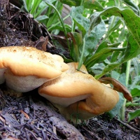
“Chipmunks” in Days Fork
I should have investigated the little guys before just throwing a common name at them, but these are actually Golden-Mantled Ground Squirrels, Spermophilus lateralus. They do look very similar to Chipmunks, but they are lacking stripes on their faces, so they’re not. A special thank you to my friend who raised the question. 🙂


Antelope Island beyond Grandeur Peak
When hiking in the Wasatch Mountains, depending upon one’s elevation, one can see past the mountaintops and into the beyond…and in this case, out into the Great Salt Lake…where one can discern the familiar silhouette image of Antelope Island…approximately 30 miles to the north and west.
I made this image from the mountainside in Bowman Fork, one of the tributary drainages that run south from Millcreek Canyon…just east of Salt Lake City, Utah, USA.

Mineral Fork in June…part two….
Here we are again, picking up where we left-off at the end of the other post, Mineral Fork in June…part one…. This is the mining artifact that we couldn’t really see at the end of the trail in the next to last photo of the other post…and this is also the location where I was standing when looking down upon the person and trail in the very last photo of the previous post.

And another “people shot” below to help add some perspective to the grandness of the location….

The below photo shows the trail in August of last year, 2012…taken at essentially the same location…so you can see how much of it is covered with snow in the above photo.

This is my first sighting of a mountain goat out in the wild, ever. I’ve heard and read that they were in the area….and are usually found very high in the more rocky aspects of the Wasatch Mountains…. This one happened to be waaaaaay up on the side of the cirque, or bowl, at the end of the fork/valley….and I was waaaaaay down on the trail, so this is the best photo that I could get…but you can still tell what it is…right?

Below, my son is sitting on a rock about 50-75 yards down from the head-water, or origin, of the stream that runs the entire length of Mineral Fork and joins Big Cottonwood Stream at the other end, roughly four miles away. Imagine walking about that distance back up into the bowl that is behind him and listening to water running under the rocks…. It was quite loud…almost rushing, as it passed beneath the scree and finally made its way out from under the rock and became a recognizable stream…..and Holy Buddha, that was some cold water!

And here I am on a rock in the middle of the nascent stream…loving my little spot in the mountains…..

My son and I followed this lower switchback trail up to the higher switchbacks (that you can see in the earlier post), but went off trail and followed the stream through its windings and droppings in elevation back down to a a similar location on the opposite side of the canyon…which affords us this distant look at the trail as it begins to climb upward. These prominent switchbacks cause this trail to be referred to as the “zigzag trail” in various literature on the area…and can be seen clearly from the mountain ridges several miles to the north.

Here’s another view of the zigzag trail, below, that I’ve provided to help with scale and proportion again…. Can you see the two people highlighted against the snow…slightly below and to the left of the center of the photo?

This is the eastern ridge of Mineral Fork…facing south…and illuminated with the full brightness of the afternoon sun.

And this is a final look at Mineral Fork…looking backwards, though, toward its beginning at Big Cottonwood Canyon.

If you’d like to see a visual reference to where Mineral Fork is situated in Big Cottonwood Canyon itself, you can click on this link to be taken to my last post that includes a map of the area….find the central spine of mountains in the approximate middle of the map and then find the second purple pin up from the bottom of the image.
As always, thank you for being here, for spending a bit of your time with me…I hope you’ve enjoyed exploring another section of the Wasatch Mountains, just east of Salt Lake City, Utah, USA.


how to feel small…on horseback….
Another view of Twin Peaks and Bells Canyon from a different perspective…and yes, there are horses with riders…tiny in comparison with the grandness of the mountains…but you can find them about 1/4 of the way up from the bottom…very close to the left edge of the photo….

Slate Gorge on the Provo River
I made this photo in October, 2010 during my first visit to the area…high up in the Uinta Mountains of Summit County, Utah, north and east of the Salt Lake Valley. This riverbed will soon (?) be under the crush of the raging snow-melt and we’ll have to wait until the late summer and fall to see the slate bottom again…..


Hiking toward Grandeur Peak…on a snowy Sunday in March….


I have been up here six or seven times over the last couple of years, but never under conditions such as these. The mountains had received somewhere between one and two and a half feet of new snow over the last four days…and while, yes, I am ready for true spring like the rest of us, I couldn’t believe the beauty of the snowy mountains and trees while I was out there. So here you are, more snowy pictures from Salt Lake City, Utah, USA…I hope you enjoy them as much as I do…..
Twin Peaks from afar…in September
A few months ago, I hiked up Porter Fork from its trail-head in Millcreek Canyon, essentially did the loop or horseshoe-shaped trail around Mt. Raymond, and then went down Bowman Fork back to its trail-head in Millcreek Canyon. Near the base of Mt. Raymond, which is technically on the north side of Big Cottonwood Canyon and faces south, you can see into the other drainages or tributary canyons that lie perpendicular and head in a southerly direction from Big Cottonwood Canyon, which runs east and west; I hope all of that makes sense. At any rate, you can see Twin Peaks (11,330/11,328 ft) near the top center of this image…the drainage that is down and slightly to the left of the peaks is Broads Fork…and if you take the ridge-line to the left, you might notice Dromedary Peak (11,107 ft) as the last prominence…which you might remember is just above and to the right/west of Lake Blanche and the other Sister Lakes…and lie in the drainage called, Mill B South. When I’m out hiking, I always find it fascinating to encounter new views or perspectives of the places I’ve visited in the mountains and canyons…such wonderful and beautiful places…..
To see more images of Twin Peaks, Broads Fork, Dromedary Peak, and Lake Blanche, you can scroll down and utilize the “Search” feature near the end of the page to locate several posts about those subjects.

My Mountains….
There is much that we simply cannot see when we are down in the valleys and canyons of the mountains that surround us…however…when we find ourselves perched atop a ridge-line or peak, it is almost as if the world has been opened for us and we can see…and see. I found myself atop the ridge-line between Days Fork and Cardiff Fork a couple of weekends ago…and almost could not believe the view. These are some of the various peaks that comprise our Wasatch Mountains…the eastern border for the greater Salt Lake Valley.


Upper Red Pine Lake, last….
You might remember the other two posts on Upper Red Pine Lake…but you can visit them here and here if you’d like to refresh your memory before continuing to the images below…or afterward…or not….


Sister Lakes – Lake Florence
You might remember from my earlier post about Lake Blanche that there are three sister lakes situated in what has been referred to as the Hidden Valley…at the end of a drainage or tributary canyon, Mill B South, which extends off of Big Cottonwood Canyon, just south and east of Salt Lake City, Utah, USA.

I think I’ve probably already provided as much of the interesting history of the area as I might, so the remainder of this post and the following one on Lake Lillian will be simply sharing the natural beauty of the area. You might recognize Dromedary Peak in the photo above from another earlier post…as you can see here, it provides an appealing backdrop for Lake Florence…and Lake Lillian, as well.

The above photograph shows another side of Sundial Peak, which you might have seen in a couple of other posts, but probably most significantly in the Lake Blanche post referred to earlier. The rocky and beautifully treed ridge above is what you would find between Lakes Blanche and Florence…and in the below photo (taken in July, 2011), you see the waterfall/drainage that leads from L. Blanche to L. Florence. With the greatly diminished snowfall this past winter season, there was very little water flowing between the lakes this year.

The next three photos are very similar, but demonstrate slightly different perspectives of Lake Florence and the rocky backdrop of Dromedary Peak. You might notice a couple of people toward the right side of the second photo below…I don’t know who those folks are, but they had camped at the location overnight and help to add a bit of dimension to the beautiful orange/red rocks that form a portion of the bowl for the lake.

As I mentioned in the Lake Blanche post, dams were built on each of the lakes to preserve a certain amount of water per year…water that was collected from the snow-melt that occurred each spring. The dams were built over a period of several years, started in 1905…completed in 1934…and then breached in 1972 when they were deemed no longer necessary.

If you look closely, you can see a small portion of Lake Lillian…right behind the skinny finger of a dead tree immediately to the left of the dam…on the far left side of the above photo.

For those who are interested, the trail that leads to the Sister Lakes is approximately three miles/4.8 km in length and has an elevation gain of about 2,600 ft/792 meters, with Lake Blanche being at about 8,900 ft/2,713 m and Lake Florence, 200 yards/183 meters to the west at 120 feet/37 meters lower. Sundial Peak is measured at 10,320 ft/3,146 m, Dromedary Peak is at 11,107 ft/3,385 m. The entire Sister Lakes area falls within several thousands of acres that are designated as the Twin Peaks Wilderness Area, which is part of the Wasatch National Forest.

Aside from the beautiful reflection of the ridge in the above photo, you can also see where the waterfall is missing (mentioned in regard to photo #3) in the rocky cleft near the middle of the image.

Wildflowers on the little ridge behind the dam on the far west side of the lake…I checked six on-line resources and can’t identify them properly, but I’m guessing that they’re from somewhere in the Sunflower family….

Similar images, above and below, but from different perspectives….

I’ve included this last photo from July, 2011, so you can see Lake Florence with a bit more water in it…and with a nice snow-patched mountain back-drop…you can also see Lake Lillian in the background.

I hope you’ve enjoyed visiting Lake Florence in the Wasatch Mountains of Utah. The next post in the series will focus on Lake Lillian, the smallest of the Sister Lakes in the Hidden Valley area of Mill B South, in Big Cottonwood Canyon….
Red Pine Stream
This is the drainage from the two/three lakes waaay up at the top of the trail…maybe not technically called “Red Pine Stream,” but that’s what it is, so…. I took this a couple of weeks ago when Fall was barely making its presence known in our Wasatch Mountains….