Colorful Desert…”supellex varia ad desertum”
I believe I have already shared some images from my springtime wanderings in the state trust land north of the White Tank Mountains in northwest Surprise, AZ…but I didn’t share many of the floral images…so here they are…covering a range of something like 22 days…three Sunday morning visitations.

Interesting name for the ones below…”Blue Dicks.” I prefer the alternative name of Desert Hyacinth…just sounds better, somehow…Dichelostemma capitatum.

Chia, below….Salvia columbariae.

Rounded a bend in the trail and found this mass of lupines…Arizona or Coulter’s lupine…something like Lupinus sparsiflorus.

Closer….

….with their telltale eight leaves….

Lupine and a single Golden Poppy…Eschscholtzia mexicana.

A view to the north and east from the state trust land….

Lupine and Desert Fiddleneck…Amsinckia tessellata….

And the near ubiquitous Brittlebush…Encelia farinosa.

Orange Globe Mallow, Sphaeralcea munroana, with Lupine.

Probably Buckhorn Cholla, Cylindropuntia acanthocarpa…as the spines are much closer than we usually see on the Staghorn Cholla, Cylindropuntia versicolor.

Red Brome…Bromus madritensis.

Lupine…in preparation (parabatur).

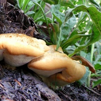
Desert Chicory…or New Mexico Plumeseed…Rafinesquia neomexicana.

Desert Bluebell…Phacelia campanularia.

That’s all for now…Quod ut ‘quia iam omnia.
White Tank Mountains – State Trust Land
In April of the past year I went trespassing onto State Trust land that lies north and west of the White Tank Mountains.

I have now obtained my permit and can hike, shoot guns, park my truck, camp, get drunk and disorderly, or just otherwise mind my own business out there in the fenced desert of western Maricopa County.

On that first foray, I noticed the barely visible zigzag road on the side of the distant mountainside and purposed to get there someday, sometime, some other not-scorching Arizona morning. Those are clumps of mistletoe hanging/subsisting in the palo verde tree in the below photograph…and creosote/greasewood in the foreground.

So that’s where I went with purpose yesterday morning, back to that formerly trespassed land. My plans for the day had been canceled and I jumped at the opportunity to get out there, to get out into the out-of-doors that lies just northwest of the town where I reside…to get into the literal desert just out there and beyond.

I’ve mentioned in the past how I find much of the desert so unappealing, especially when viewed from a distance, when all one sees is the rolling or flat or hilly or mountainy landscape or terrain or whatever you might call it…those locations where it just looks like dirt with green fur on it, if there’s even any fur to be seen.

And I’ve said, too, that I have intentionally gone out into the same desert looking for what my inner eye/heart might consider to be beautiful, compelling, possessing of that “something” that would make my mountain/forest loving soul, say, “Yes…it is beautiful out here.”

I have also shared that in order to find those things, I have had to look closer, to find those smaller things that give me pause, that insist upon being captured in images for me to reflect upon later, for me to enjoy.

And so I endeavored….

…to bring back images that were not too bleached-out by the late morning and early afternoon sun…

…to capture what might be a compelling representation of the essence of the lives that inhabit such a landscape…

…photographs that demonstrate what the desert is inside of that bleakness…the rolling fuzzy dirt of our West….

…the persistence of living…

…the evidence of death and decay…

…and the beautiful juxtaposition of harsh and delicate…

…sharp and soft…

…loud and mute…

…and may they be treasured…all.

Thank you….
ADDENDUM: here is a nice link from AZBackcountryExplorers.com that provides helpful information about using State Trust Land.
Desert trespass….
On one side of the blown fence, it’s county park property, on the other side, it’s state trust land…land set aside for the state to use for its various institutions.

On one side, you drive through a gate with an attendant and pay $7 to access the park property for a day, and on the other you pay $15 to access it for a year, unless you’re a hunter, and then you only have to pay for the hunter’s license.

I parked outside of the gate on the trust side, stepped over the mangled fence, and went wandering through land that had single and double-track trails leading all over the desert, went past old watering ponds and tanks that had been marked with graffiti, stepped over spent shotgun and other shells, shattered clay pigeons, and beyond the other marks of man searching for more ancient trails of creatures that care nothing for trespassing signs and fences.

There were small and larger dry waterways with footprints of birds, mice, rabbits, lizards, and coyotes; tracks worn into the desert floor that were likely created by cattle heading toward the watering ponds from those past eras when the land was (more?) open and access was simply granted by desire; and tracks of time’s passing in the already parched desert grasses and wildflowers, the new buds on trees still waking in middle Spring, and various sizes of cacti in their growing, thriving, and dying.

Should I be concerned that I will be arrested for stealing the intellectual property contained in the images I made while trespassing on State land…..?
Walkin’ Jim Trail and beyond….
The morning started with the alarm and coffee and then a neighborhood street that led to Bell Road, to the Sonoran Desert Parkway, to Lake Pleasant Parkway, to the Carefree Highway and west past Lake Pleasant, then to Castle Hot Springs Road, and finally, five miles north to a trail-head in a parking lot that has been re-fenced with silver wire that is new against the morning, untarnished and unvarnished with desert sun and windblown sand, unrusted in the elements, bright and confining, restricting of early hikers looking for familiar portals that ride now in memory alone.

Common and uncommon things mix in a November sunrise.

Somewhere between light enough and yet not enough…we see destinations unfolding with the trail…like the white caps on the tips of the many saguaros’ arms with their densely packed and unfolding new spines…things to come.

One of many crossings of Cottonwood Creek…a familiar place with wild burros, great horned owls, and collared peccaries….

and lying on the desert floor, looking east…and finding that “distant fairyland of wonder and bright alarm.”

A creosote frame leaving an aromatic resin on fingertips….

…and the tiny treasures of desert wildflowers….

Still heading west…with the destination in the upper right corner…after many winding turns, hills, valleys, dips, and desert meadows….

A distant spot of white in a green and brown world….

Zoom….

Gaining elevation and looking east…we can see a bit of Lake Pleasant tucked into the haze covered hills…

…and south…faint waves of them…green, purple, blue…white…and gone….

Higher now, more of the lake…and the landmark of Castle Hot Springs Road. You might remember that the haze is from California’s wild fires back in October/November.

The stark contrast of yellow against the greens and browns of the desert is a welcome change…it is even a surprise sometimes.

Walkin’ Jim Trail follows Cottonwood Creek up into the mountains, all the way from Castle Hot Springs Road…when the occasional mis-adventurer loses the trail on the way down the mountain, all he has to do is locate the proper drainage down from that mountain and follow it back into the stream-bed…and back to the parking lot where he started….

There were tadpoles larger than jellybeans in the pools along the way…more desert mysteries…marvels…Sonoran Desert surprises….
Desert light….
By far, I have found it best to be on these desert trails shortly after sunrise, or within the first hour thereafter….

…the light is more pleasant and provides for greater character in the subjects found along the way.

Two Sundays ago found me hiking south on the Black Canyon Trail from the Bumble Bee trailhead. I have hiked this stretch of the trail once before…on a sweetly cloudy day in July of last year.

I didn’t go as far with this present hike, as the day’s heat was growing more oppressive and casting something of an ugly hue on everything that caught my eye.

I didn’t get out hiking in the earlier part of Spring, and have therefore missed the rich greenness that all of these wild grasses and flowers must have added to the area.

I love the pearl-like clusters of the creosote or grease-wood bushes…especially when the morning light is behind them.

The desert, overall, wasn’t especially attractive on this particular morning, but when I stopped along the trail to look more closely, I found plenty to admire.

All of these images are from the first two and a half hours heading out on the trail.

And in the photo below, a glance skyward brings a reminder of what can happen if one tarries too long…..

desert deja vu
I’ve only been hiking about two dozen times since I moved back to Arizona almost two years ago, and all of the hikes have been on different trails…or on different sections of the same larger trail…with very little overlap of covering those sections, and on only one occasion, hiking the exact same trail. When I was hiking in Utah, I covered many of the trails several times, five or six times, and even more than ten times on another two trails…they were compelling locations with easy and quick access, short drives from the house, where minutes later I would find myself in the woods…alone, or with very little company.
You might remember from various earlier posts that I’ve hiked several segments of the Black Canyon Trail…and on some of those occasions, I went past the “formal” or designated section’s length and continued onward for another mile or two onto the next section….this is some of the “overlap” that I mentioned above.

When I found myself about 100 yards to the left of the location on the trail where I made this photograph, I had an overwhelming sense, a physical knowing, that I had been there before. It actually caused me to stop and turn in slow circles looking for something that was familiar…some landscape feature that was significant and placed somewhere in my memory. I found nothing…there was nothing that I recognized…and I can usually recall sections of most trails that I’ve hiked, both here and in Utah…the stuff just gets cataloged away, mental images…. Anyway, I “felt” that I had been here before…and I’ve never “felt” that way before when out hiking. Yes, certainly, I’ve visually recognized and absolutely “known” where I was out on hikes that I had made before…but this is the first time that I “felt” or physically “sensed” that I was somewhere where I had been previously…but didn’t visually recognize….so it was odd…strange…made me wonder about juju and voodoo and other related and unrelated things.
Maybe it was a physical memory as a trauma response to the last time that I was at this location…at the spot right there in this image. I had hiked north to this point…and then went off trail to go exploring in what looked like the chute or body of a rock-lined water-course and water fall…the point that you can see immediately to the right of the large light-colored rock that is just left of center in the image. I went off trail…something that I don’t do unless I leave a note saying that I’m going to do it…something that maybe I shouldn’t do, shouldn’t have done…something like that. But…I did…bush-whacked it right through the desert and climbed over the associated boulders and scree, balanced on shifting rocks with my full back-pack…and then there was a buzzing and flying creature screaming into and around my face, darting at my eyes, nearly clinging to my glasses with wings flashing and whining face-close and loud…my hands swatting at the winged-beast, trying not to knock the glasses off my face…and finally, the bastard landed next to the outer corner of my right eye and JABBED its stinger into my face flesh and then its poison or toxin lightning-darted and ran and flew through the nerves and up into my scalp, Real Lightning Darts, not any of that fake shit you see on TV or read about in pulp magazines…but the real stuff, right through the muscles and upward…screaming WOW WOW WOW!!!!!
Hmm……..
So…after I steadied myself, assessed the minimal damage to my confidence that I was really somewhere that I should have been…realized that my eye wasn’t going to blow-up…realized that I could still see…with just a little bit of blur…I sat on a rock, had a bit of water, and then continued my explorations….cautiously…listening….watching. There were no hissing and rattling snakes or attacking Gila Monsters…no circling round of buzzards aloft overhead…and no banjo-playing hill-billies…..just a dried desert waterway that hadn’t been visited by any creatures that would have left tracks since the last rainfall. After looking around in the wash and making a few photographs, I climbed back up the hill to an area close to where I made this image, and then continued up the trail, still heading northward, the same direction I was going before stepping off the trail to go exploring and getting my face stung.
I think my spirit of adventure had been abated somewhat…and I didn’t actually continue very far up the trail. I had already gone more than a mile past what I had planned, so I did a 180 and then started back to the truck.
In my post-event analysis of this experience of “feeling” that I had been there before without actually recognizing it, I think that this must have been where I turned around…where my body decided for me that it was time to go home…that my still hyper-alert mind had probably cataloged the whole surroundings and then recognized them before my conscious mind did when I returned to the place while hiking south from a different trail-head….some seven months later.
So…that’s the photograph…that’s the place…that’s my little bit of desert deja vu.
I hope it was fun for you, too. 🙂
Black Canyon Trail north from Emery Henderson Trail-head
Sunday morning, November first of this present year, eight minutes into the hike…the desert looked like…well, the desert as I have come to know it. This stretch of the Sonora Desert has become rather familiar. I’ve been on this trail eight times now and have covered more than 40 of its 70-plus miles…and this stretch is the furthest south that I have been. There might be still one more track south of this trail-head, but being familiar with the area south of here, I doubt that I’ll head in that direction.

The early twists and turns of the trail, and the crossing and re-crossing of dry water-ways or creek-beds had brought me up a slight rise and pressed on toward a flatter plain that would soon give way to other and more declivities and inclines as I progressed northward. I had seen this particular Saguaro from further back and wondered if the trail would take me anywhere near it. If one were “looking for a sign” when lost out here in this desert wild, that someone might be tempted to view this as some kind of guide, or not…. I found it to be a significant landmark that, when coming from the other direction a few hours later, told me that I was very close to the end of my excursion.

I’ve seen mistletoe several times, but don’t know that I’ve ever posted any images of it. Here it is in it’s context…

…and here it is again, but in a closer view.

The living and the dead of the eternal desert….

An old-school trail marker, faded by severe summer suns….

The trail was actually quite a bit lower than the surrounding desert in the below photo. I thought it provided a nice shrub-height perspective.

I thought there would be more to this section of the trail than there actually was. I came to the end much sooner than I thought I would and then stood there mid-trail thinking, “Is that all…really?” It felt much too early to head back to the truck and I wasn’t inclined to marching further on the already familiar track, so I headed off-trail to explore a couple of the minor peaks in the area. After reaching the top of one, I turned north and found a pleasant-enough view of the desert beyond…the trail toward the middle of the image is the one that would take me up toward the trail-head at Table Mesa Road.

I’m still adjusting to this desert hiking and have to admit that I’m sometimes disappointed in the landscapes and panoramas…sometimes they seem so featureless…or plain…. Someone once said that it’s not what we look at, but what we see that’s important…so I press myself to look more closely in my search for beauty out here…I try to look at things with a fascinated, scientific mind sometimes, framing things within contexts of what I’ve read and learned about this type of landscape.

And when looking much closer, I find cliffs and canyons covered in lichen….not literal cliffs and canyons, of course, but ground-level rocks that are covered in the moisture-dependent and fragile, yet enduring yellow lichen that appears with more frequency than one would expect out here.

I notice, too, the varieties of plant life and the slope and angles of the land as it rises and falls in its relationship with, among other things, the comings and goings of water, the sculpting that occurs from the drainage and collecting of its seasonal rains…and then I wonder at how it looked when it was born, this volcano-riddled desert…..

From the top of another hill, I looked south and over the desert that pressed against roads and homes and saw the distant ridges that were clothed in the mists of commerce and civilization…smog…and was touched by the irony of this kind of “beauty” being the result of something so inherently unappealing.

When I was taking a biology class in college several years ago, one of our assignments was to conduct a field study or observation of the plants growing on one slope and compare them with the vegetation found living on an opposite hillside. I had recollections of that experience when I was climbing the hill in the above image. I had just been on a different slope that was only dirt and rock with very little of anything growing there and no evidence of animal-life, and then visited this particular slope that was covered with wild grasses and Jojoba shrubs, desert trees and cacti, and had wild burro and rabbit droppings, as well as lizards and chipmunk/squirrel type creatures scurrying about….what a difference there was to be seen in the opposite extremes of the lay of the land……when looking closer.

I don’t know the name of the tree in the above image, but it provided an uncommon and inviting shade as I was descending the last hilltop of my afternoon explorations.

And lastly, an image that presents the contrast of near and far in the Arizona Sonora Desert…not very compelling when viewed from a distance, in my opinion, but strikingly beautiful and fascinating when experienced up close and personal.
“The Walking Dead” Saguaro…..
I’m not a great fan of popular culture, but this one was too fitting to deny….

I’ve never seen a Saguaro cactus in such a state of decay…upright…

…so it came to me that it must be a zombie Saguaro…escaped from the set of The Walking Dead TV series….just hanging-out in the Sonora Desert, just off the Black Canyon Trail……
Or not…..
Hillside Saguaros and Waves of Mountains
Looking east from near the headwaters of the mostly dry Cottonwood Creek, north and west of Lake Pleasant, Arizona.

Beyond Bumble Bee
For the past several years, I have used the website “Weather Underground” to follow the temperatures and weather patterns in the places I have lived…and to even look back nostalgically at places where I used to live to see how things are going there, as well. Two weeks ago I was watching the temps for Black Canyon City and hoping the high temperatures for the coming weekend would be lower than they were a couple of weeks earlier when I was out in the murderous heat and so desperately needed a Coke after my hike. I was in luck…the high for this past Sunday was supposed to be under 100 degrees, which meant that I could get out on the trail around 6:00 or 6:30 in the morning, have a nice long hike, and still make it back to the truck before the heat became too ugly.
This first image is of the Bradshaw Mountains, looking northwest at 6:25 am. The larger trees in the foreground are a variety of Palo Verde. During drought conditions, the trees lose their leaves and are still able to perform photosynthesis through the chlorophyll in the “bark” or exterior covering of all of the branches and trunk…. You can also see several Saguaro cacti in the background….

Most of my hiking in recent months has been along the Black Canyon Trail. I’ve been out six times and have covered nearly half of the 78 mile long trail. If you care to look at a map, find Interstate 17 (I-17) going north from the Carefree Highway at the extreme north end of Phoenix, and imagine a trail running in the desert just west of the interstate and east of the mountains further west…and follow that space northward for about 80 winding and curving miles up toward the Prescott National Forest. The portion of trail featured in this post is what can be found heading north from Bumble Bee Road, about 25 miles north of Phoenix.
This second image is primarily of the “Pancake Prickly Pear” cacti and the dried wild grasses common to this area.

If you’ve ever driven that same interstate north from Phoenix and remember seeing a rest-stop sign for “Sunset Point,” and you stopped to look west at the huge, folding and flowing mountains, this hike took place on the stretch of trail just west from that Point. The first part of the hike was mainly in the shade, as the trail followed the contours of the west facing side of the hills and was situated far enough below the ridge-line that I was out of the sun for quite a while.

It’s been a while since I shared multiple photos as single images, instead of presenting them in the “gallery” form, but I thought the photographs from this hike would be easier to appreciate in this larger form…so here they are, placed in chronological order and covering the first two and a half hours of the hike. There will be a couple of other posts in which I share groups of photos from particular stopping-places along the trail.

These “desert hills” and mountains are quite different than the ones I hiked for the last few years, but they are still inviting…and tempting me to go off-trail to explore the draws and ridges that we can see off in the distance. I won’t likely do that until the temperatures are much lower, however, just in case some “unplanned” event occurs and I’m out there for longer than I had planned to be.

In the below photo, you can see an unpaved portion of Bumble Bee Road in the lower right corner, a couple of hiking trails further in the distance, and then a section of what might be the Agua Fria River bed in the area just left of center.

I had knelt to take some closer shots of Prickly Pear cactus fruit and saw this single piece of bone lying nearby. A quick search of the area failed to reveal any other bones, so this one must have been carried away and left here when the predator or scavenger was finished with it.

At just past 7:30 am, the sun was sufficiently over the ridge to highlight the shrubs and grasses along the trail in the next photo. This one, right here, is where peace comes out on the desert’s trail, to me anyway…I love this image, this piece and the broader whole that it represents…the light, the smell, the quiet whisper of the morning breeze among the branches and grass, the un-nameable feeling that comes with being right here…is wonderful, and compelling, and alluring, and causes me to go out into the unpleasant heat that I know is quickly approaching, so that I can be here on a trail like this one.

I would prefer temperatures in the 60s or 70s, but it was far from ugly-hot when I stopped to make this next photo. At only 7:45 am, it was still rather nice for desert hiking.

My only companions for the day were two mountain-bike riders who passed me on their way out and back in again…and the occasional cow, a couple of dozen lizards, multitudes of desert birds, and a single rabbit…

Lines of demarcation, thine and mine, in the images above and below, but I was and am thankful that there was a gate or opening that allowed passage…so many places we’d like to go, it seems, have fences around them…. At 8:10 in the morning, I wondered how many mornings and afternoons these fence and gate posts have seen….their colors and textures speak of years…decades, even.

The photograph below shows another view of an image that you have likely already seen…but I wanted to share it again within the context of the hike, moving from place to place, with the morning green of the desert hills and mountains, and the richer green, like a ribbon of life that thrives along a desert waterway, a sometimey waterway that likely runs below ground for most of the year, but rises again with the various seasons’ rains and floods.

I usually become aware of the Gambel’s Quail when they burst from the underbrush as I pass too close to their hiding place, but I happened to spot this silent sentry as she sat alone in the tree some 20 or 30 yards off-trail. Even at this distance you can tell that this one is a female, as her head is missing the distinct color pattern that is common to the male.

And lastly, several blooms on a Graham’s Pincushion cactus. I found several of these along the trail and, upon first seeing them, thought they were headbands that some hiker had lost along the way…they were so very bright, so vibrant in the middle of all the earth-tone, desert colors that surrounded me, they just seemed so unnatural and out of place. And if you’re interested, the flat, paddle-like leaves around this cactus belong to the Jojoba plant….

So…that was most of the hike, on the way out, anyway…and minus a couple of detours that I will share later. Thank you for visiting…and I hope you have a nice week.
mid-winter green in the desert hills
I made this image a couple of weeks ago…on the day that happened to be one year exactly since I had taken my last hike in the Wasatch Mountains near Salt Lake City, Utah. Oh, how the scenery has changed in that passing of time!!


low clouds on the desert hills
I meant to hit “preview,” but hit “publish,” so here it is anyway…all images made along the Carefree Highway yesterday morning….


Indian Mesa, Arizona
I’m not sure when I learned about Indian Mesa, but I think it might have been when I was researching Lake Pleasant Regional Park and the surrounding area for an earlier post this summer, but at any rate, I’ve been meaning to get out there and see it for myself…and decided to do it after the temperatures cooled off a bit. So, this past Sunday, November 9…when the high temp for the day was supposed to be somewhere between 85 and 89 degrees, I started out early with the hopes of getting there and back before it got too warm. Things didn’t start well for the venture, though…the directions were missing a few pretty important details, or maybe I was just a bit dense that morning…so I didn’t arrive at the trail-head quite as early as I had hoped. It was still a very nice hike…and it even included water and Cottonwood trees….


If you’re interested in learning more about Indian Mesa, you can click on this link to be taken to the Wikipedia site that covers the subject. You can also click on this link to learn more about the Hohokam people who are thought to have lived there…. If you’d like to view the images in a larger format, you can click on any photograph in the galleries to be taken to a slide show…and then click on the “View Full Size” in the lower right corner of each frame to see the larger version.


 at Indian Mesa ruins")


The Saguaro Cactus – a study of variation within a theme….
In my driving through town and into the desert where I live, just north of Phoenix, Arizona, I have seen a great variety of the Saguaro Cactus…while they are all the same type of plant, it is incredible how different their sizes and shapes can be. I made these photos on my hike to Indian Mesa, just north of Lake Pleasant, in north central Maricopa County…and only about 15 miles north of my home. You can click on any photo to be taken to a slide-show that provides a closer view. If you’d like to learn more about the cactus, you can click on this link to the Arizona Sonora Desert Museum’s fact sheet.


A little bit of Lake Pleasant….
I haven’t been out ON the lake yet, but these are a few more images from when my little one and I went out to the park for a visit a week or so ago…it was more of an exploration, actually…checking it out to see what we might do out there in the future.

I had mentioned in an earlier post how it was so strange in my experience to have Saguaro cacti in such proximity to a body of water like this…but here it is again….

Sailboats and speedboats on the lake….we hope to be out there in a canoe at some point….

While it’s not a true panoramic shot, comprised of multiple images, it is a wider-angle image that provides more of a panoramic view of a portion of the lake and the surrounding desert…with more of those Saguaro cacti and other desert vegetation.

Here are a couple of links about Lake Pleasant Regional Park in case you’d like to read more about it…just click on the blue highlighted text to visit the official park website and the Wikipedia site.
vistas del desierto
This is just a glimpse of the area to the north and west of Lake Pleasant Regional Park. It was close to noon on another “severe clear” day in the desert of Arizona…not a cloud in the sky and only recently attaining the temperature of “quite warm.”

Even though I lived in Arizona for over 20 years before moving to Utah, I still find it amazing to see so many Saguaro cacti. I guess I didn’t get out of the city very often back then…something that I have already begun to remedy since returning.

incongruity
Sailboats and Saguaros just don’t seem to go together, but here they are at Lake Pleasant Regional Park in the extreme northern part of Maricopa County, Arizona.

saguaro sunset silhouette
The high daytime temperature yesterday was somewhere in the low hundreds…and I imagine that it was probably somewhere in the mid-nineties by the time I came down from the mountain and entered the neighborhood again. There had been clouds across the sky throughout the day, but they didn’t stick-around long enough to be significant with regard to the sunset…but there were bats circling the near-nighttime sky, skittering and dashing about as bats will do, finding their evening (or morning?) meals on the wing and disappearing into the blue-black shadows of the coming night.
I was walking back to my truck when I noticed the dash of white-yellow-orange-pink of the airliner passing the silhouette forms of these statuesque Saguaro cacti. If you’re interested, the tree is a Palo Verde and the more linear stalks of cactus in the lower right corner are from a single Ocotillo…..
Wishing you a pleasant evening from north Phoenix, Arizona, USA.

Seven Springs Saturday
I drove north and east this morning…this false first-Saturday in this new and old place. The true first-Saturday found me unloading moving trucks, you might remember…so this was the first one that was unoccupied with moving and other commitments. Like I said, I drove north and east, trying to get closer to a huge mesa in that direction which has been unimaginatively named “Table Mesa,” which to my understanding of Spanish, ends up meaning “Table Table.” At any rate, I found myself only in the vicinity of that place, several miles, really, away and away from the redundantly named mass of earth and rock that rises table-like from the lower desert floor. The below image is not of that so-named bit of earth and rock, it is of other bits of desert hillsides and ridges and crowning greenery and thorns and chunks of volcanic waste that was left behind after their own genesis in the eons of millennia passed.

After completing something of a circle of exploration of that land to the north and east of my current desert home, I headed further north and east along new, yet known roadways…heading toward another desert town that lived in my mind as a memory of only a brief visit that occurred nearly 30 years ago. Along the way, however, I encountered a sign that said “Seven Springs,” a notion of a recommended place that I in particular might enjoy…”It’s green,” she said, “with a stream and cottonwood trees…,” things that reminded me of another place, one that I have only recently left behind…. The last image in the below gallery shows what the area looks like from above, rather…a nearby area that is strikingly similar to the visited Seven Springs….a flowing greenery that lives in the narrow draws and folds that lie between rolling hills of raw and scorching desert sand and rock.


I don’t know the name of the delicate flowers in the below image…but I found the plant along the waterway of Seven Springs….

…and a yellow Columbine, too…a different version of my favorite flower ever, the Colorado Columbine that I shared in this post if you’d care to see a similar and beautiful creature in pristine, alpine white….

This Saguaro Cactus is probably close to 25 feet in height…one of what must be hundreds and hundreds of the amazing plants that populate the vast Sonora Desert of Arizona.

Forgive the slightly washed-out white of the Saguaro’s blossoms in the below image…today was one of those days that my sons refer to as “severe clear,” meaning that there was not a cloud in the sky as the June sun beat down upon the desert….

Roadside Prickly Pear Cactus…under a near-noon sun….

Hmm…maybe a little fuzzy on the yellow….

…and lastly, looking down the hillside into one of the desert draws…you can probably make-out the dry waterway…a sandy pathway that leads to the greener foliage in the upper left of the image…early Spring rains and Summer monsoon storms bring the stream-beds to life again….

Thank you, Rachel….